The Chicago Portage archive is available for download as a single .zip file from here. The archive includes copies of The Chicago Portage Ledger, photographs of the site, and the video "Connected Worlds: The Story of the Chicago Portage.
Furthermore, this December, we are launching a new platform for our unique digital collections.
Please take a moment to preview it and let us know what you think!
What waterways did this portage connect?
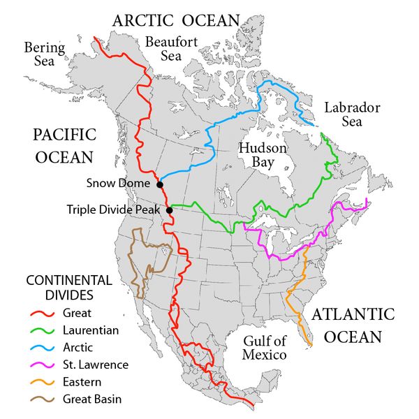
The Chicago Portage was the connection between the Chicago and Des Plaines Rivers. A long narrow marsh called "Mud Lake" * lay between the two rivers. Its east end was usually around Albany Avenue (3100 W) on the near southwest side of Chicago. From the east end of the marsh, a portage trail led to the west end of the West Fork of the South Branch of the Chicago River. The Chicago River connected with Lake Michigan and through Lakes Huron, Erie and Ontario, to the St. Lawrence River, and out to the Atlantic Ocean.
Mud Lake normally drained into the Des Plaines River through a short, wide, reed choked braided channel called Portage Creek on its west end around present day Harlem Ave. (7200 W). The Des Plaines River flows into the Illinois River which in turn flows into the Mississippi River and down to the Gulf of Mexico through the heart of the north American continent.
Also see
Chicago Portage Ledger Vol. 2, No. 1, January/April 2001
and
Chicago Portage Ledger Vol. 2, No. 2, May/August 2001
Next page: How was the Chicago Portage created?


